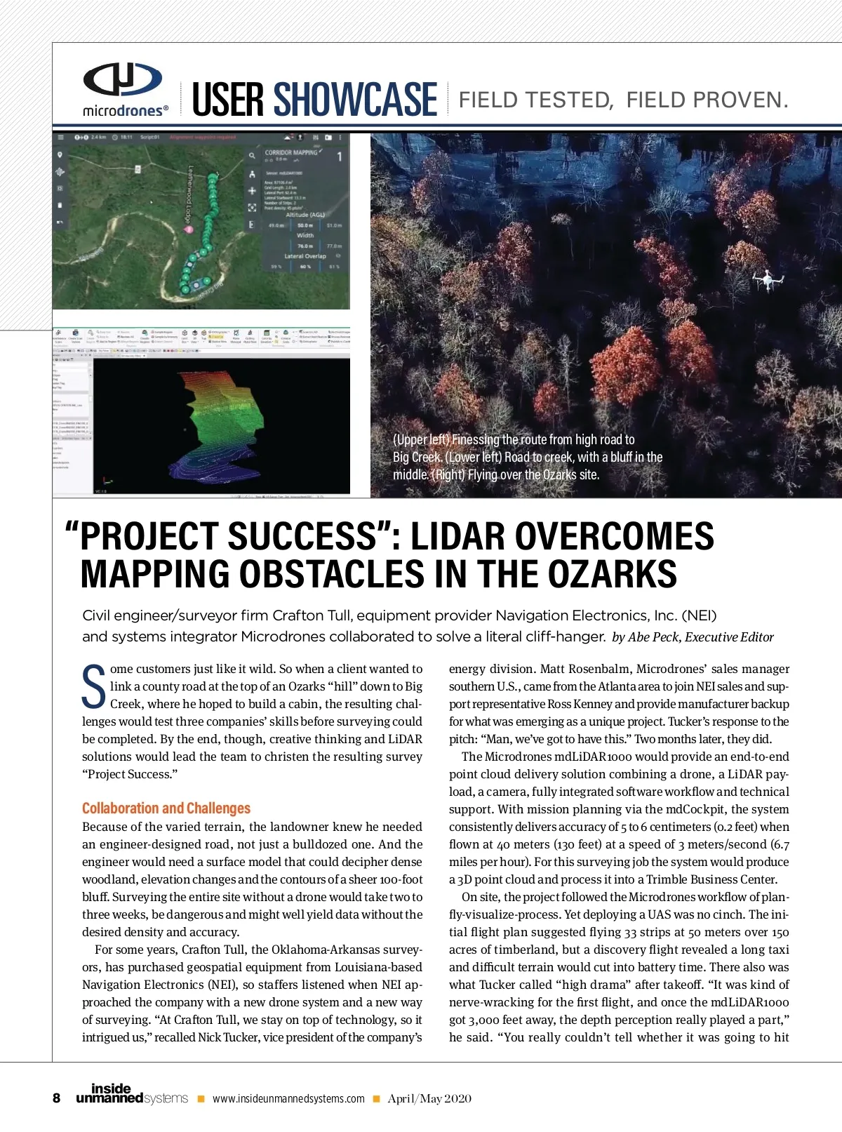
USER SHOWCASE FIELD TESTED, FIELD PROVEN. (Upper left) Finessing the route from high road to Big Creek. (Lower left) Road to creek, with a blu in the middle. (Right) Flying over the Ozarks site. “ PROJECT SUCCESS”: LIDAR OVERCOMES MAPPING OBSTACLES IN THE OZARKS S Civil engineer/surveyor fi rm Crafton Tull, equipment provider Navigation Electronics, Inc. (NEI) and systems integrator Microdrones collaborated to solve a literal cli -hanger. by Abe Peck, Executive Editor energy division. Matt Rosenbalm, Microdrones’ sales manager southern U.S., came from the Atlanta area to join NEI sales and sup-port representative Ross Kenney and provide manufacturer backup for what was emerging as a unique project. Tucker’s response to the pitch: “Man, we’ve got to have this.” Two months later, they did. The Microdrones mdLiDAR1000 would provide an end-to-end point cloud delivery solution combining a drone, a LiDAR pay-load, a camera, fully integrated so ware work ow and technical support. With mission planning via the mdCockpit, the system consistently delivers accuracy of 5 to 6 centimeters (0.2 feet) when own at 40 meters (130 feet) at a speed of 3 meters/second (6.7 miles per hour). For this surveying job the system would produce a 3D point cloud and process it into a Trimble Business Center. On site, the project followed the Microdrones work ow of plan-y-visualize-process. Yet deploying a UAS was no cinch. The ini-tial ight plan suggested ying 33 strips at 50 meters over 150 acres of timberland, but a discovery ight revealed a long taxi and di cult terrain would cut into battery time. There also was what Tucker called “high drama” a er takeo . “It was kind of nerve-wracking for the rst ight, and once the mdLiDAR1000 got 3,000 feet away, the depth perception really played a part,” he said. “You really couldn’t tell whether it was going to hit ome customers just like it wild. So when a client wanted to link a county road at the top of an Ozarks “hill” down to Big Creek, where he hoped to build a cabin, the resulting chal-lenges would test three companiesʼ skills before surveying could be completed. By the end, though, creative thinking and LiDAR solutions would lead the team to christen the resulting survey “Project Success.” Collaboration and Challenges Because of the varied terrain, the landowner knew he needed an engineer-designed road, not just a bulldozed one. And the engineer would need a surface model that could decipher dense woodland, elevation changes and the contours of a sheer 100-foot blu . Surveying the entire site without a drone would take two to three weeks, be dangerous and might well yield data without the desired density and accuracy. For some years, Cra on Tull, the Oklahoma-Arkansas survey-ors, has purchased geospatial equipment from Louisiana-based Navigation Electronics (NEI), so staffers listened when NEI ap-proached the company with a new drone system and a new way of surveying. “At Cra on Tull, we stay on top of technology, so it intrigued us,” recalled Nick Tucker, vice president of the company’s 8 inside unmanned systems www.insideunmannedsystems.com April/May 2020
Inside Unmanned Systems April/May 2020: Page 8