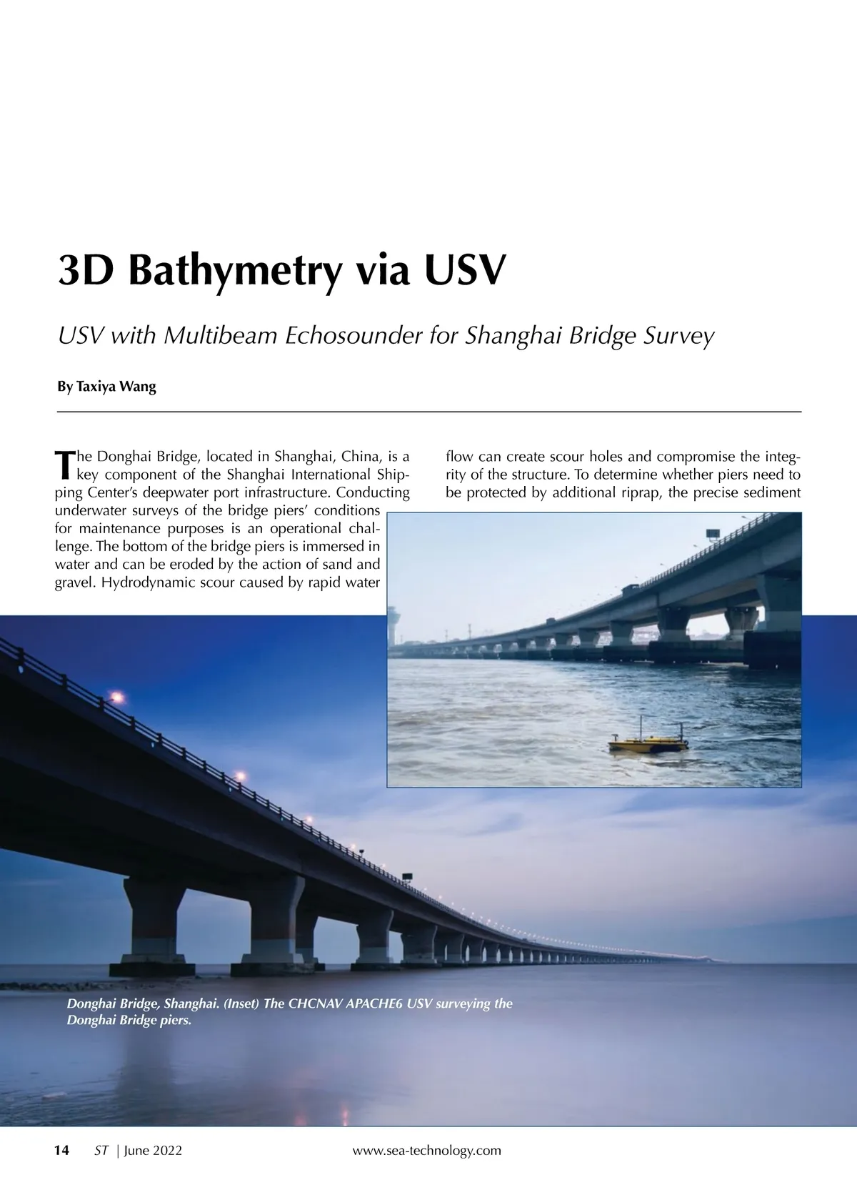
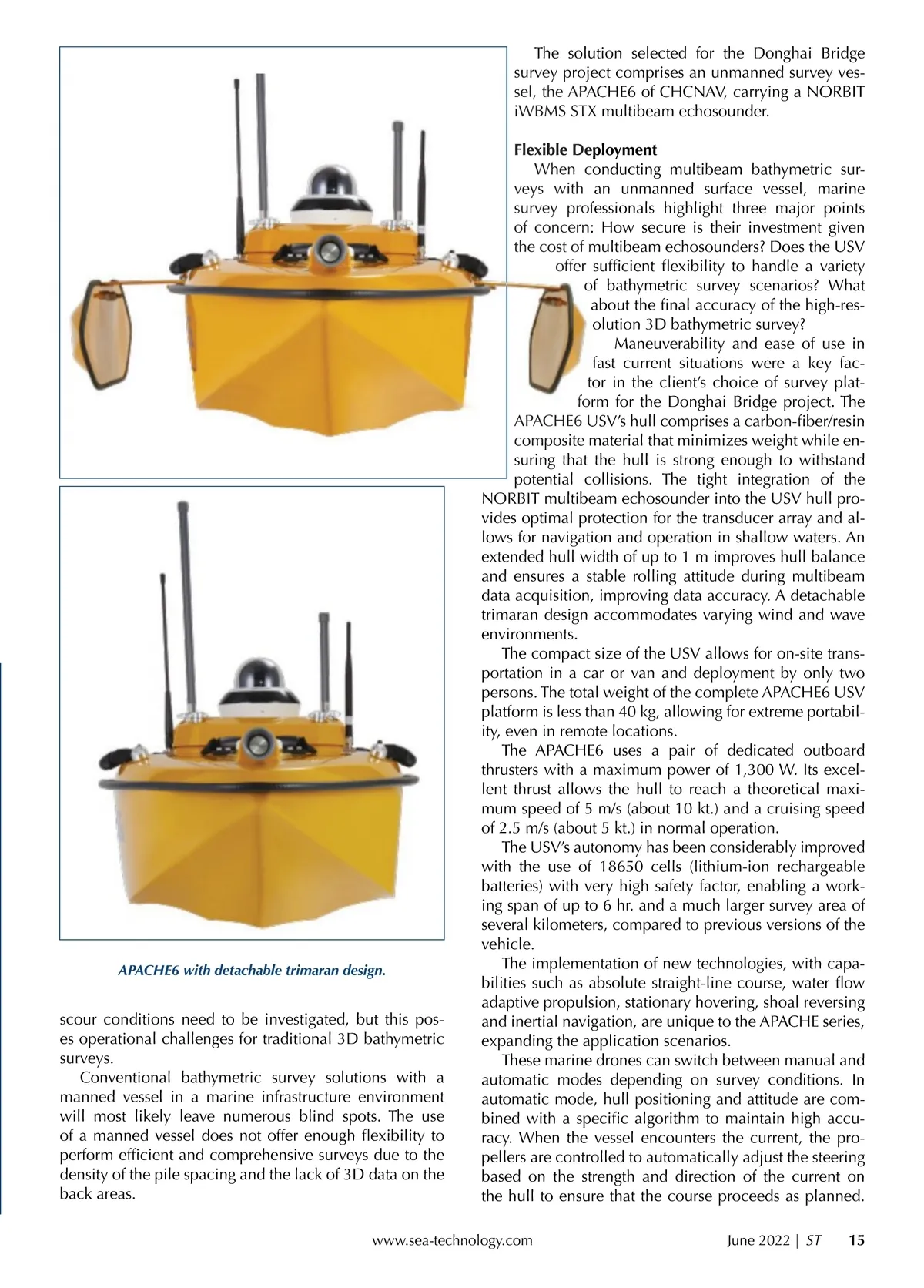
The solution selected for the Donghai Bridge survey project comprises an unmanned survey ves-sel, the APACHE6 ACHE6 of CHCNAV, carrying a NORBIT iWBMS S STX S X multibeam echosounder. Flexible Deployment eployment When conducting multibeam bathymetric sur-veys y with an unmanned surface vessel, marine survey y professionals p fessionals highlight three major points of concern: : How secure is their investment given the t e cost of o multibeam echosounders? Does the USV offer suf cient exibility to handle a variety of bathymetric survey scenarios? What about the nal accuracy of the high-res-olution 3D bathymetric survey? Maneuverability and ease of use in fast current situations were a key fac-tor in the client’s choice of survey plat-form f rm for the Donghai Bridge project. The APACHE6 USV’s hull comprises a carbon-ber/resin A composite material that minimizes weight while en-suring that the hull is strong enough to withstand potential collisions. The tight integration of the NORBIT multibeam echosounder into the USV hull pro-vides optimal protection for the transducer array and al-lows for navigation and operation in shallow waters. An extended hull width of up to 1 m improves hull balance and ensures a stable rolling attitude during multibeam data acquisition, improving data accuracy. A detachable trimaran design accommodates varying wind and wave environments. The compact size of the USV allows for on-site trans-portation in a car or van and deployment by only two persons. The total weight of the complete APACHE6 USV platform is less than 40 kg, allowing for extreme portabil-ity, even in remote locations. The APACHE6 uses a pair of dedicated outboard thrusters with a maximum power of 1,300 W. Its excel-lent thrust allows the hull to reach a theoretical maxi-mum speed of 5 m/s (about 10 kt.) and a cruising speed of 2.5 m/s (about 5 kt.) in normal operation. The USV’s autonomy has been considerably improved with the use of 18650 cells (lithium-ion rechargeable batteries) with very high safety factor, enabling a work-ing span of up to 6 hr. and a much larger survey area of several kilometers, compared to previous versions of the vehicle. The implementation of new technologies, with capa-bilities such as absolute straight-line course, water ow adaptive propulsion, stationary hovering, shoal reversing and inertial navigation, are unique to the APACHE series, expanding the application scenarios. These marine drones can switch between manual and automatic modes depending on survey conditions. In automatic mode, hull positioning and attitude are com-bined with a speci c algorithm to maintain high accu-racy. When the vessel encounters the current, the pro-pellers are controlled to automatically adjust the steering based on the strength and direction of the current on the hull to ensure that the course proceeds as planned. June 2022 | ST APACHE6 with detachable trimaran design. scour conditions need to be investigated, but this pos-es operational challenges for traditional 3D bathymetric surveys. Conventional bathymetric survey solutions with a manned vessel in a marine infrastructure environment will most likely leave numerous blind spots. The use of a manned vessel does not offer enough exibility to perform ef cient and comprehensive surveys due to the density of the pile spacing and the lack of 3D data on the back areas. www.sea-technology.com 15
Sea Technology June 2022: Page 15